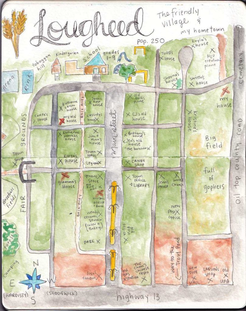
Making Maps – My Hometown
I went to a session about Indigenous relations (and making sure you are in good relations) and one aspect of introducing yourself that was discussed as vitally important was rooting yourself in place and where you come from. This ties closely to the importance of ancestors and passed on knowledge.
I stewed on that for a while, subconciously, and a few months later I found myself drawing a map of my hometown from my childhood memories.

The thing with this map, since its based on my childhood, is that its out of scale, based on landmarks and important places of my youth, and my method of orientation (farmer’s directions and landmarks). It spans a long time-frame, 20 years in fact, where the town certainly changed by my memories have not.


Wish some of the people(houses) featured here could all see this, well done Darlin’!
randomly came across this online while googling Lougheed AB. Love it Meredith!
Hi Jeremy! Thank you – I hope you and your family are doing great :)